Nicknamed the "Whiskey" route, this path is known for being more challenging and slightly more expensive than the Marangu route.
Among all Kilimanjaro routes, Machame stands out as one of the best options, offering excellent acclimatization and good value.
While considered a difficult trail, it’s ideal for adventurous trekkers with some hiking or backpacking experience.
The route boasts breathtaking and diverse scenery, though its popularity means more crowds, slightly diminishing its solitude. Climbers approach the summit from the southwest, descending via the Mweka route, passing highlights like the vast Shira Plateau, the optional Lava Tower scramble, the dramatic Barranco Wall, and the awe-inspiring Southern Icefield.
Though steeper and more physically demanding than Marangu or Rongai in some sections, Machame’s overall trekking experience is more manageable.
Its excellent acclimatization profile includes multiple "walk high, sleep low" opportunities.
This challenging yet rewarding trek crosses five distinct climatic zones, offering ever-changing landscapes.
An added advantage is the option to split the pre-summit climb, allowing trekkers to rest before the final ascent.
However, due to its many strengths, this trail is very popular—expect plenty of fellow hikers.
The drive from Arusha to Machame Gate takes approximately 3 hours, offering scenic views as you pass through the village of Machame, nestled along the mountain’s lower slopes.
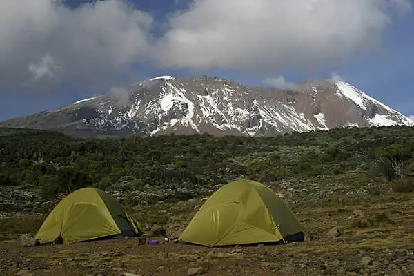
From the park gate, the trek begins through lush rainforest along a winding path that gradually ascends the ridge. The lower section of the trail can often be wet and slippery, so gaiters and trekking poles are highly recommended. After a steady hike, we arrive at our first overnight stop—Machame Camp.
Elevation: 1830m / 6000ft to 3050m / 9950ft
Distance: 11km / 7mi
Hiking Time: 5–6 hours
Habitat: Montane Forest
Meals: Lunch, Dinner & Breakfast
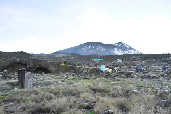
After breakfast, we depart from the lush forest glades and follow a steadily climbing trail. The path crosses a scenic valley and ascends along a rugged, rocky ridge. As we gain elevation, the landscape begins to change. The route then veers westward, tracing the contours of a river gorge, ultimately bringing us to the Shira Campsite.
Elevation: 3,050 m (9,950 ft) to 3,850 m (12,600 ft)
Distance: 5 km (3 miles)
Trekking Duration: Approximately 4–5 hours
Habitat: Moorland
Meals Included: Breakfast, Lunch, and Dinner
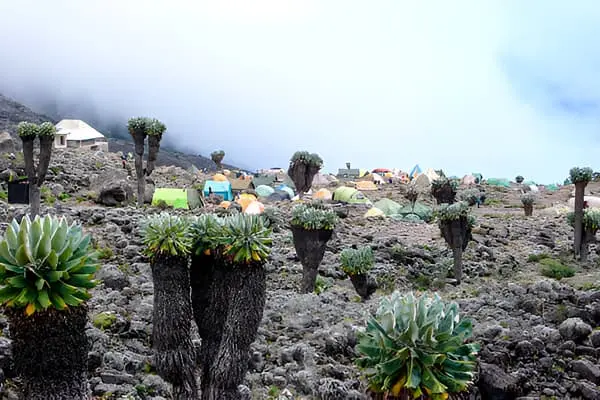
Leaving the Shira Plateau, the trail ascends steadily eastward along a ridge, passing a junction that leads toward Kibo Peak. From there, the route turns southeast toward the striking Lava Tower, also known as the “Shark’s Tooth,” standing at an elevation of 4,650 m (15,250 ft). After a well-earned hot lunch near the tower, the path descends into the scenic Barranco Valley and down to Barranco Camp. Despite ending the day at a similar elevation to where you began, this stage is vital for acclimatization, helping your body adjust to the increasing altitude in preparation for summit day.
Elevation: 3,850 m (12,600 ft) to 4,000 m (13,000 ft)
Distance: 10 km (6 miles)
Trekking Duration: 5–6 hours
Habitat: Semi-desert
Meals Included: Breakfast, Lunch, and Dinner
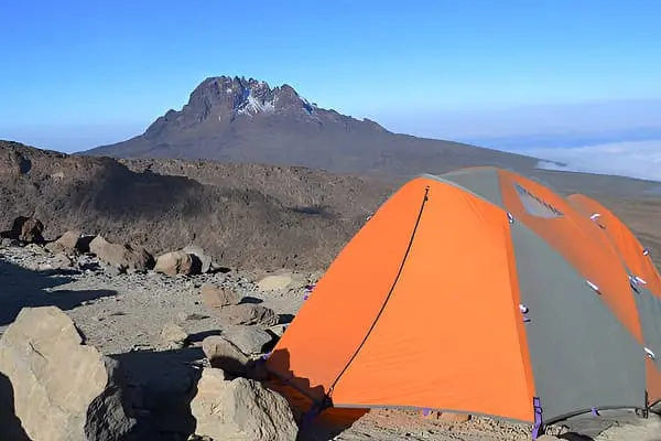
After breakfast, the climb begins with a challenging ascent up the steep Barranco Wall (elevation: 4,250 m / 13,900 ft), a thrilling scramble that rewards you with stunning views. The trail then winds through the scenic Karanga Valley (elevation: 4,050 m / 13,250 ft), before reaching the junction that connects with the Mweka descent route. From here, the path continues upward to Barafu Camp. At this point, you will have completed the Southern Circuit, which provides sweeping vistas of the summit from multiple perspectives. Barafu Camp offers a stark, alpine desert setting with dramatic views of Mawenzi Peak and the summit of Kibo looming in the distance.
Elevation: 4,000 m / 13,000 ft to 4,700 m / 15,350 ft
Distance: 9 km / 6 mi
Hiking Time: 6–8 hours
Habitat: Alpine Desert
Meals: Breakfast, Lunch, and Dinner
At midnight (around 12:00 AM), you’ll begin the final ascent toward the summit, navigating between the Rebmann and Ratzel glaciers. The route heads northwest and climbs steadily through loose scree, making this the most mentally and physically demanding section of the trek. Upon reaching Stella Point on the crater rim, you'll pause for a brief rest—just in time to witness a truly breathtaking sunrise. Those who climb swiftly may even catch the sunrise from the summit itself.
From Stella Point, a final one-hour push—often through snow—leads you to Uhuru Peak, the highest point on Mount Kilimanjaro and the entire African continent. Standing at 5,895 meters (19,340 feet), this is a moment of pure triumph.
After spending time at the summit, you’ll begin your descent, heading straight down to Mweka Camp. You’ll stop at Barafu Camp for a well-earned lunch along the way. The descent is steep and can be slippery, so trekking poles and gaiters are recommended. At Mweka Camp, you’ll celebrate your final night on the mountain, reflecting on your unforgettable accomplishment.
Elevation: 4,700 m / 15,350 ft to 5,895 m / 19,340 ft (Uhuru Peak)
Descent to 3,090 m / 10,150 ft
Distance: 5 km / 3 mi ascent | 13 km / 8 mi descent
Hiking Time: 5–7 hours up | 5–6 hours down
Habitat: Stone scree, glacier, and ice-capped summit
Meals: Breakfast, Lunch, and Dinner
After breakfast, you’ll begin your final descent down to the Mweka Park Gate, where you'll receive your hard-earned summit certificates. As you descend into the lower forest zone, the trail may be wet and muddy—gaiters and trekking poles are helpful. The weather is typically warmer at this elevation, so lightweight clothing such as shorts and t-shirts will likely be comfortable, though it’s wise to keep rain gear and a light jacket within reach.
Upon arrival at Mweka Gate, a Memorable Vacation Africa vehicle will be ready to transfer you back to your hotel in Arusha—a journey of approximately 2.5 hours. Take this time to rest, reflect, and celebrate your incredible achievement.
Elevation: 3,090 m / 10,150 ft to 1,680 m / 5,500 ft
Distance: 10 km / 6 mi
Hiking Time: 3–4 hours
Habitat: Montane Forest
Meals: Breakfast
ID: YourWeChatID